
← TLÁLOC

The depth behind
each product.

Technology developed at TLÁLOC to connect territory, crops, climate and water. Shared infrastructure for experiences focused on the market.

We understand the territory when its signals connect.

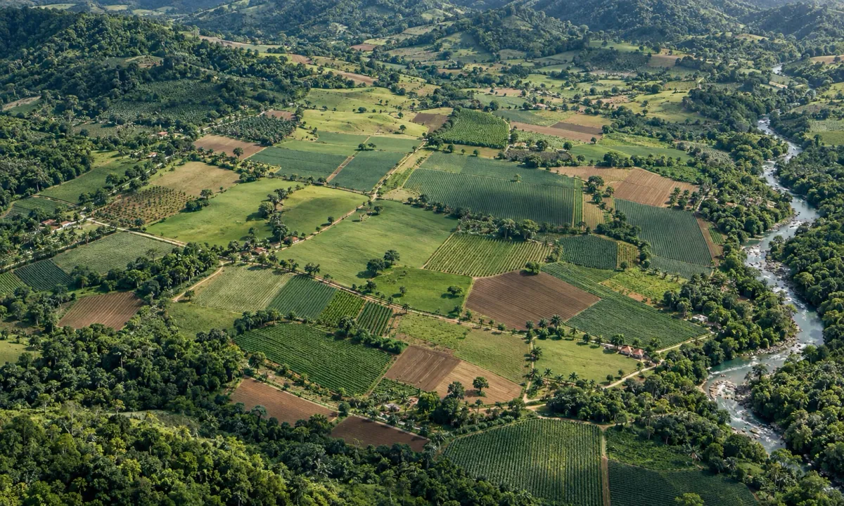
Conceptual diagram · No actual field data
TLÁLOC / TERRITORIAL STUDYFIELD GEOMETRY
ANALYSISPERIMETER WATER CONTEXT CLIMATE EXPOSURE
Georeferenced property / Illustrative representation
PROVENANCE · CONTEXT · TRACEABILITYThe institution retains the final decision.

A property is more than a crop.

It is an economic system exposed to production, climate, water and territorial conditions that affect its insurability and repayment capacity.

Information often arrives fragmented, late or without clear provenance.

TLÁLOC organizes territorial, production, climate and water signals as comparable evidence. This helps risk teams understand the property in context and decide where further assessment is needed.

Property→Evidence→Context→Institutional decision
Production conditions

Crops, pastures and infrastructure.

An integrated view of the system, beyond a single signal.

Environment

Climate, water and territory.

Exposure placed in context within the analyzed perimeter.

Threats

Events and changes.

History, preventive alerts and comparisons over time.

Outcome

Prepared evidence.

Clear findings for committees, underwriting and risk teams.

From territory to a defensible decision.

A four-stage pathway that turns a location into a traceable institutional study.

01
⌖

Locate

The property is identified through coordinates or territorial geometry.

02
◇

Delineate

The production perimeter to be analyzed is defined.

03
≋

Analyze

The proprietary architecture processes territorial, production, climate and water conditions.

04
✓

Decide

The institution receives an auditable study to support insurance or financing decisions.

Two proprietary models. One integrated view of the field.

TLÁLOC combines satellite observation and agroclimatic context with specialized models, trained and fine-tuned internally on open-source foundations.

Technology and agricultural financial intelligence

Hunahpú

Integrates satellite analysis, software and agricultural financial context to support territorial and production assessment of properties.

Biological and biophysical intelligence

Ixbalanqué

Specialized in crops, soil, water, water stress, pests and agroclimatic data. Supports the digital twin and TLÁLOC Biotech research.

Hunahpú and Ixbalanqué operate independently or together within the digital twin. TLÁLOC develops their specialization through internal training and specialized fine-tuning on open-source foundations, with proprietary data, analysis and software architecture.

Up to 90 days

Recent history

Review of field development using satellite signals, agroclimatic context and available records.

Up to 90 days

Conditional scenarios

Exploration of possible effects on harvests and profitability under assumptions about climate, drought and exposure to phenomena such as El Niño.

The digital twin connects field history with scenarios of up to 90 days. Each study documents data, assumptions and uncertainty. The experimental extension for agricultural inputs and pests is part of the Biotech initiative.

Intelligence applied to agricultural risk.

The same proprietary architecture organizes evidence around the decision each institution needs to support.

For insurers and reinsurers

Evidence before, during and after coverage.

TLÁLOC supports risk understanding and event review without replacing actuarial judgment, required inspection or underwriting decisions.

Intelligence for the process. The insurer defines coverage, terms and the final decision.
01Pre-underwriting assessment
02Property and production system characterization
03Threats, vulnerabilities and coverage conditions
04Monitoring throughout the coverage period
05Review of events and claims
06Comparisons over time, auditing and traceability

Evidence for institutions and production teams.

The offering is defined by the territory, the purpose of the analysis and the needs of those who will use the results.

Insurers and reinsurers

AgriInsurance Intelligence

Exposure studies and comparisons over time for underwriting, monitoring and technical review of events.

Explore institutional applications ↗
Cooperatives and producers

Production monitoring

Information on crop development, water conditions and preventive alerts to guide management and explore more efficient use of water and inputs.

Institutes and organizations

Territorial analysis

Documented evidence to support agricultural programs, projects and assessment of production conditions.

The initial remote assessment uses the georeferenced property and available data, without requiring sensors or drones. The scope defines deliverables, monitoring and field checks where appropriate.

A territorial assessment that understands different production systems.

Specialized layers are combined according to the property, activity and institutional decision to be supported.

Crops and early crop health warnings

Early signals to observe development, stress and threats.

Production conditions, water stress and preventive alerts up to seven days ahead. Specialization priority: coffee, corn and sugarcane, within a foundation covering seven crops.

CoffeeSugarcaneCornBananaCocoaPineappleWheat
28documented threats · 7 crops
Livestock and pastures

Forage, vegetation and system exposure.

Pasture conditions, signals linked to forage availability, water sources, drinking points and exposure to drought.

Poultry

Environmental vulnerability of the facility.

Factors associated with heat stress and water supply context, without inferring diagnoses for individual birds.

Water resources

Presence, development and supply alternatives.

Surface water, water deficit and groundwater potential as inputs for identifying where to investigate further.

Aquaculture

Ponds and water surface conditions.

Shrimp farming, tilapia and other production systems: biological activity and the surrounding climate and water exposure.

Mangroves and wetlands

Coastal coverage and changes.

Environmental conditions and territorial factors relevant to related production activities.

More than data. A study ready for analysis.

The output organizes evidence with context, provenance and traceability to reduce friction between technical and business teams.

TLÁLOC · Property studyConceptual document

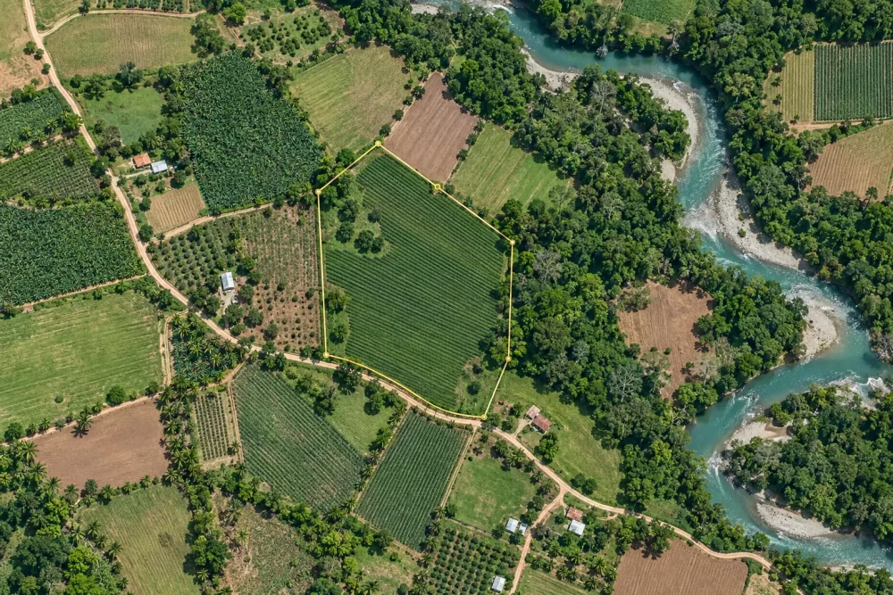
From a georeferenced property to a coherent dossier.

Executive summary, production characterization, agroclimatic exposure, water conditions and findings prepared for institutional review.

Illustrative agricultural field map with a perimeter and visual references

Conceptual illustration · Does not represent actual property data

A finding must be open to review.

Studies organize sources, context and history over time. Monitoring format and frequency are agreed with each institution.

Institutional deliverable

From study to monitoring

Initial assessment with defined scope and deliverables, integration according to the institution's workflow and monitoring by portfolio or study volume. Frequency, support and commercial terms are agreed for each project.

Complementary capability in development

Blockchain traceability

We are developing verifiable records of properties, fields, crops and input applications, linked to documents, timestamps and cryptographic anchors to support banking, insurance and production audits.

A record's integrity does not establish the truth of the original data. Traceability does not certify a product as organic, prove the absence of residues or replace field checks, laboratory testing or regulatory requirements.

Technical evidence and experience across geographies.

The architecture has been exercised through coffee analyses over time in El Salvador, locations in seven countries and historical rainfall context.

A principle of trust

Traceability matters as much as the finding.

Each study preserves context and provenance so an institution can review what supports a conclusion.

Technical case · Coffee · El Salvador19

analyses in sequence

Documented technical exercise to observe development and comparisons over time.

Agroclimatic geographic module9

locations in 7 countries

Evaluation of the geographic and agroclimatic workflow at nine locations in seven countries.

Climate context24

years of rainfall

History used for each location within that validation exercise.

International collaborationUY · CN

Uruguay and China

International exchange and technical collaboration in progress.

Indicators from documented technical exercises, interpreted according to their sources, scope and production conditions.

A vision that keeps evolving.

Biotech research and the exploration of collaborative robotics are part of TLÁLOC's evolution. They connect with the same agricultural knowledge while retaining their own development goals and stages.

Explore Biotech →